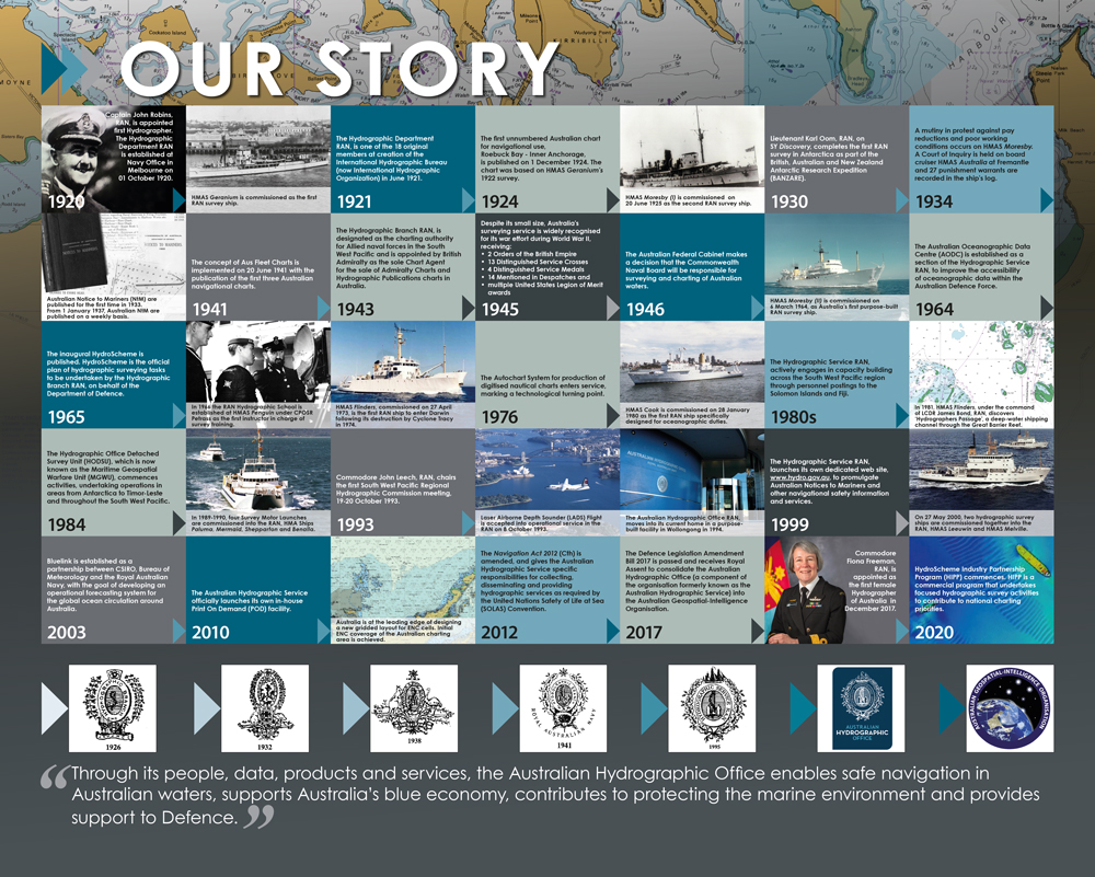
History of the AHO
- 1795: The British Admiralty Hydrographic Office is established. The Royal Navy (RN) carries out hydrographic surveys and published charts of the Australian coast.
- 1825: By 1825, the Admiralty has published a series of charts of the Australian coast.
- 1860 - 1926: The Australian colonies pay the Admiralty to conduct hydrographic surveys on an as needs basis, and at least two ships are engaged in surveying activities in Australian waters.
- 1920: The Australian Hydrographic Service (AHS) is established under the Royal Australian Navy (RAN) and assumes responsibility for hydrographic surveys.
- 1942: The RAN assumes responsibility for the publication of charts. The Australian Chart depot is established.
- 1946: The Australian Federal Cabinet makes a decision that the Commonwealth Naval Board will be responsible for the surveying and charting of Australian waters.
- 1988: The Richardson Review conducts a review of Commonwealth mapping activities and confirms that the RAN is responsible for providing hydrographic services for Australia.
- 2012: The Navigation Act 2012 (Cth) is amended and enacted and gives the AHS specific responsibilities for providing hydrographic and cartographic services under the United Nations Safety of Life at Sea (SOLAS) Convention.
- 2016: The 2016 Defence White Paper articulates that Defence would seek to replace the current hydrographic capability with an ‘efficient combination of military and commercial hydrographic and oceanographic survey capabilities’.
- The First Principles Review (FPR) of the Department of Defence is issued; a key recommendation is the consolidation of Defence’s geospatial agencies into a single agency - the Australian Geospatial-Intelligence Organisation (AGO), under the Strategic Intelligence and Policy (SP&I) Group.
- The AHS transfers from RAN to SP&I Group on 01 July 2016, with the Hydrographic Survey Force remaining in the RAN. Navy and SP&I Group now share responsibility for delivering hydrographic services required by the Navigation Act 2012 (Cth).
- 2017: On 16 October 2017 the Defence Legislation Amendment Bill 2017 is passed and receives Royal Assent to consolidate AHO into the Australian Geospatial-Intelligence Organisation (AGO).
- 2020: On 01 October 2020 the Australian Hydrographic Office marked its centenary.
The Australian Hydrographic Office marked its centenary on 01 October 2020.
Most of the stories found here are personal recollections. If you would like to submit an article or photograph, and be part of the continuing history of the AHO, please email: webmaster@hydro.gov.au.
100 Years of Hydrography
|
Our STORIES
|